


Snow to the city, everything is quiet | Winter photo in Northern Xinjiang
Ice and Snow Fairytale World - My Altay
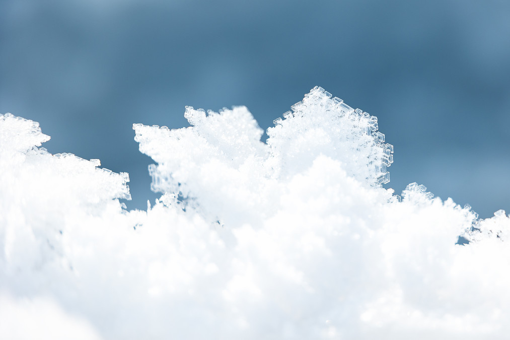
Altay's winter is like a dream, the endless snow scenery is intoxicating, the forest is covered in silver, Qiongzhi The rime is crystal clear, tranquility and brightness are intertwined, and innocence and dream coexist. Every flying snowflake is like an elf dancing in the air. The snow is not lonely under the sunshine and bonfire, but a warm and vigorous dreamy scene, which is so beautiful that it makes people speechless!
Altay belongs to the northern part of Xinjiang Uygur Autonomous Region, which is located in the northernmost part of Xinjiang and borders Russia, Kazakhstan and Mongolia. The Altay region is governed by the Ili Kazakh Autonomous Prefecture. The landforms of the Altay region are complex and diverse, mainly divided into mountains, hills, plains and deserts. The climate belongs to the temperate continental climate, with dry and hot summers and severe cold winters. The Altay region has jurisdiction over 1 county-level city and 6 counties, namely Altay City, Burqin County, Habahe County, Jimunai County, Fuyun County, Fuhai County and Qinghe County.
The Altay region has a long history of garrison culture. Since the Western Han Dynasty established the Western Regions Metropolitan Protectorate in 60 BC, the Altay region has been officially incorporated into the Chinese territory. The Altay region is an important node city in the northern channel of the Silk Road Economic Belt and Xinjiang's participation in the construction of the China-Mongolia-Russia Economic Corridor. It has three national land ports and is one of the relatively rich water areas in Xinjiang and one of the six major forest areas in the country. Famous for "Jinshan Yinshui", it is one of the origins of Chinese skiing.
The Kanas Scenic Area of Altay Region is located in the middle section of the Altai Mountains in Xinjiang Uygur Autonomous Region, which is located in the border zone between China and Kazakhstan, Russia and Mongolia. It is the only Siberian flora and fauna protected distribution area in China. Now the Kanas Lake Natural Landscape Reserve has been created here with Kanas Lake as the center. The total area is 5,588 square kilometers. The protected areas are vertically distributed from top to bottom, including glacial constant snow zone, mountain frozen snow zone, alpine meadow zone, and mountain grassland zone.
"Kanas" is Mongolian, meaning "beautiful and rich, mysterious" or "lake in the canyon", and Kanas means "king's water", which was drunk during Genghis Khan's expedition, hence the name.
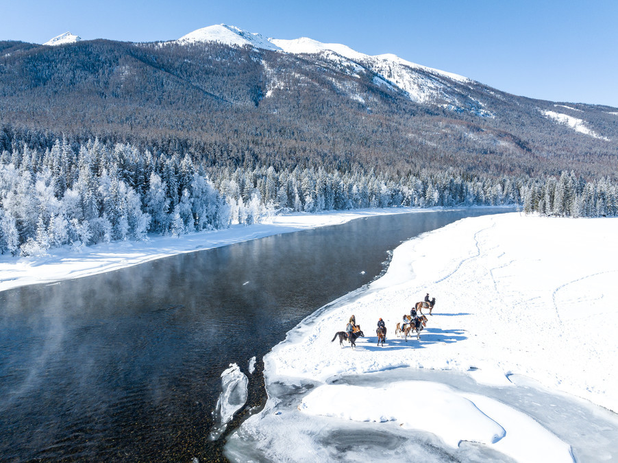
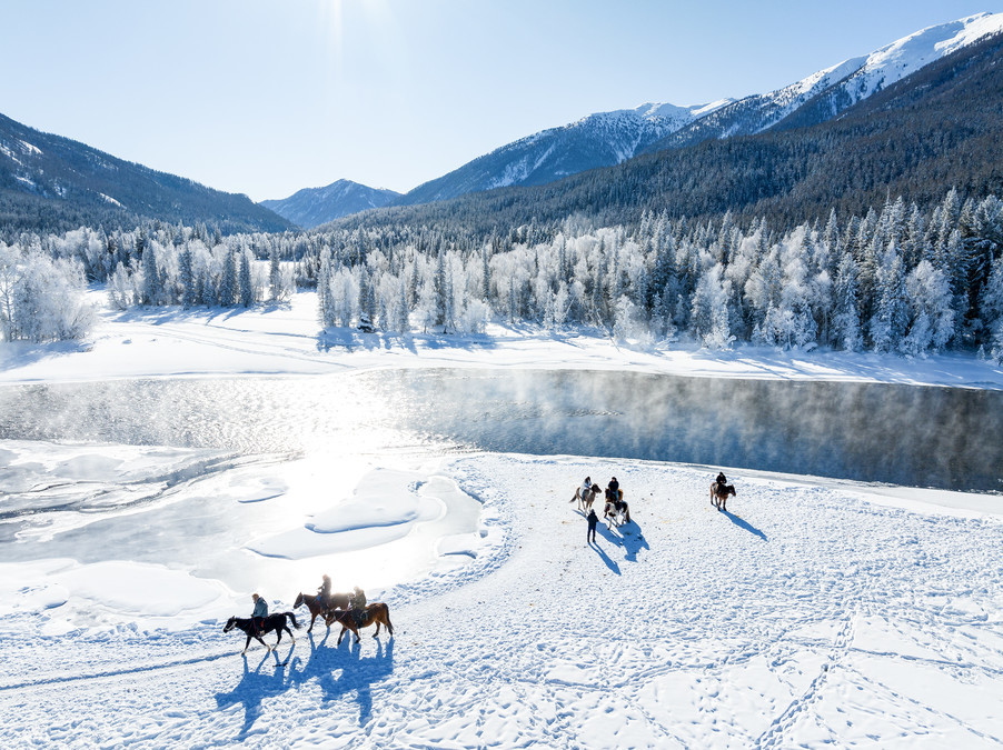
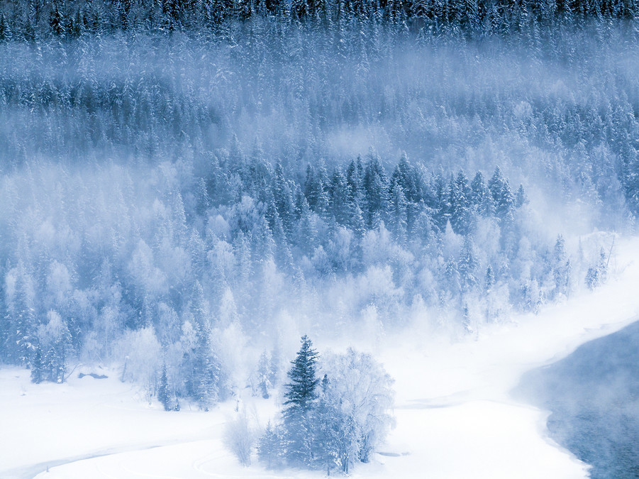
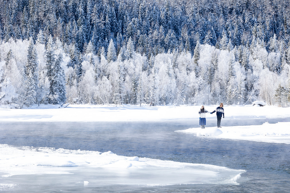
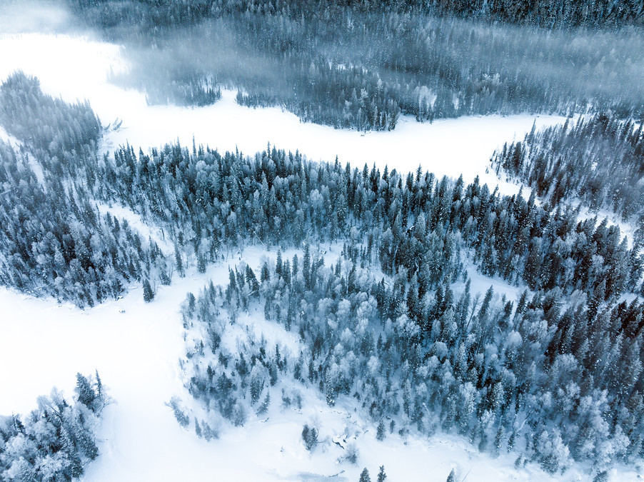
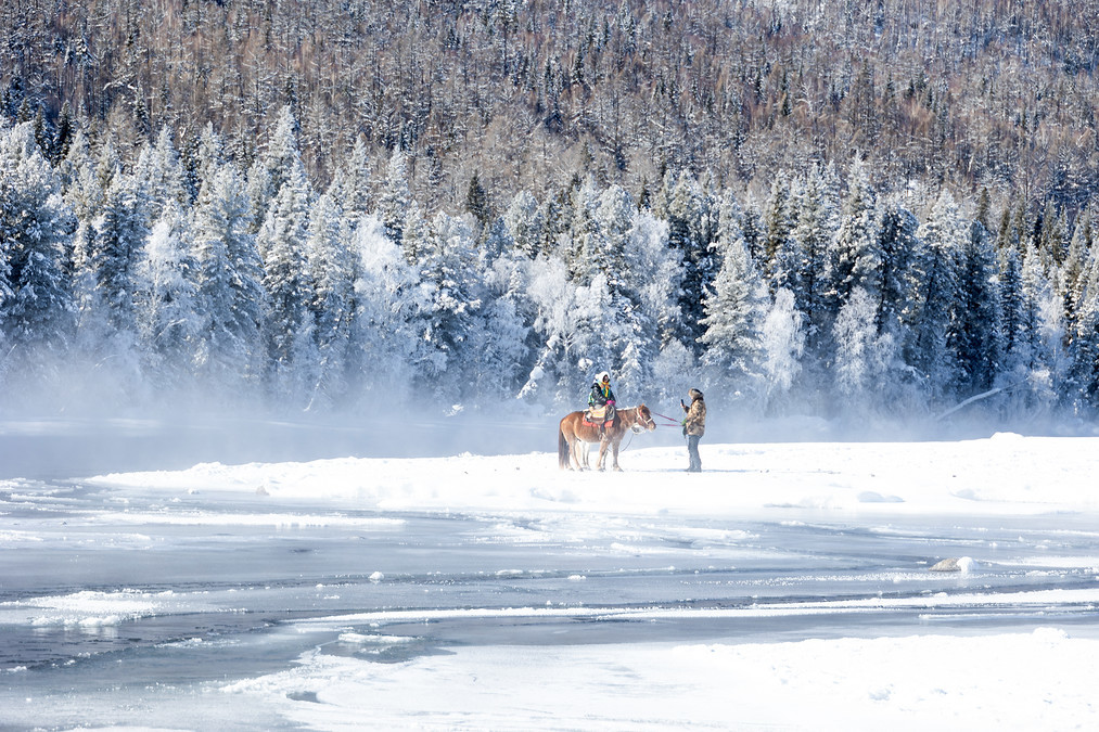
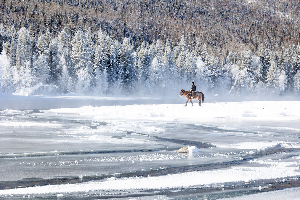
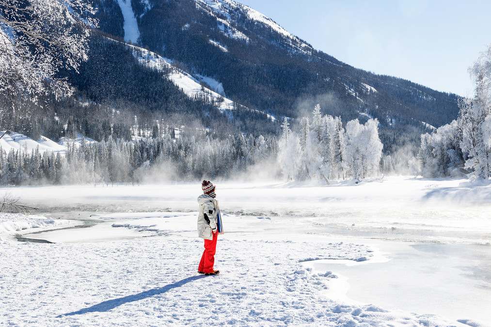
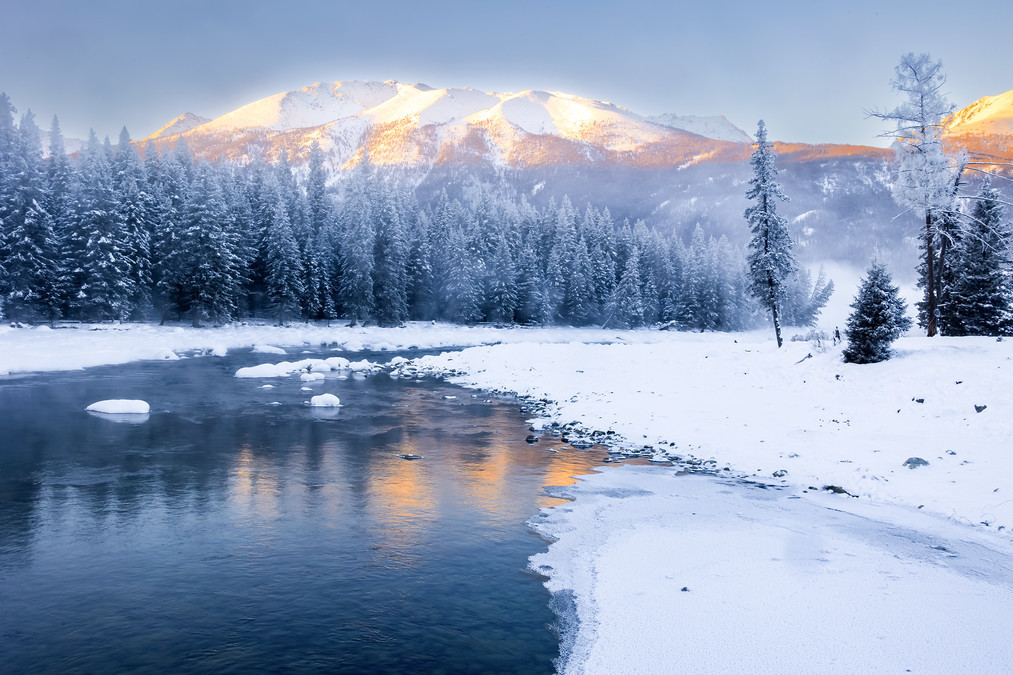
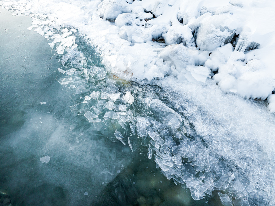
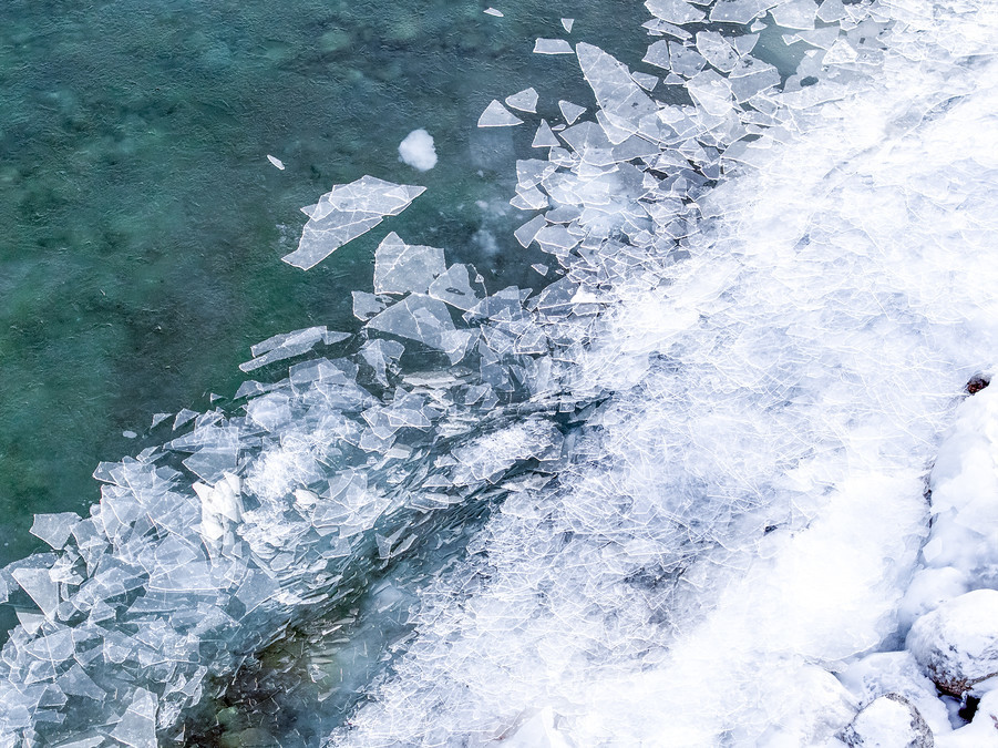
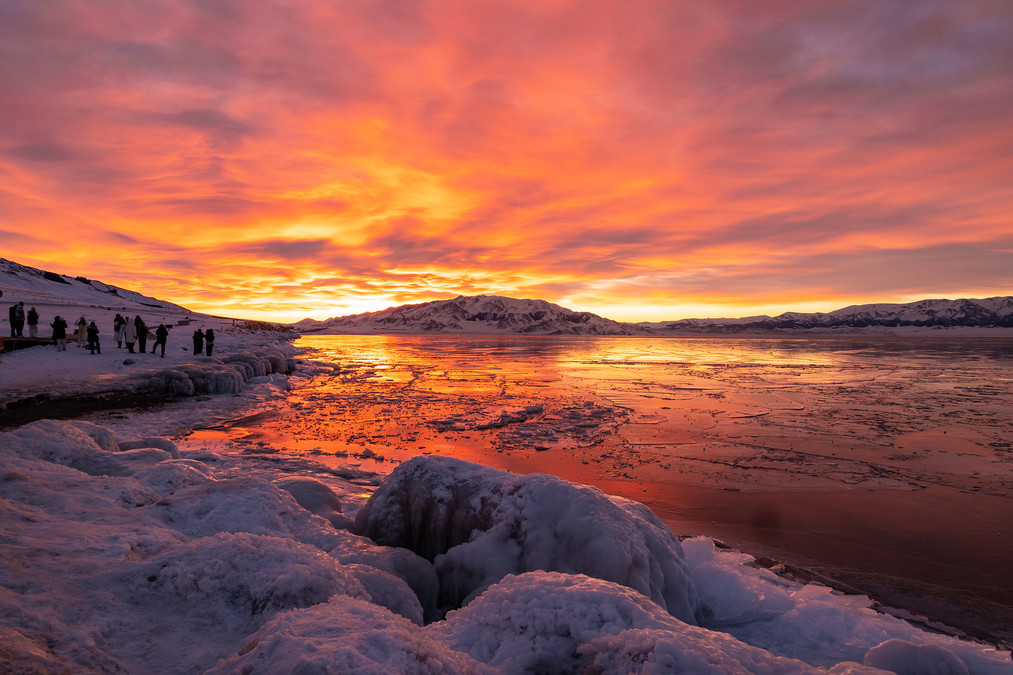
The undulating Altai Mountains are like a majestic ice and snow dragon, bringing auspiciousness to the north of the entire Tianshan Mountains. If Hemu Village in winter is the secret land of ice and snow in fairy tales, then Kanas in winter is a wonderland on earth that is stunning and addictive at first sight. The three bays of Kanas in January and February are already icy and snowy. The clear lake surface gradually freezes in the ice and snow, and a little blue lake light is exposed from time to time under the white snow cover. Thousands of mountains are snowed, and thousands of miles are frozen. The surrounding forest and sea snow fields are vast and pure, beautiful and healing.

Walking by the lake and listening to the murmur of the Kanas water monster under the ice, the river that has not yet been frozen is slowly flowing with fine blue ice cubes, rolling through the snow fields and rime-covered riverbanks with dense fog. The clear and natural atmosphere can instantly make people forget all their troubles. The pebbles on the shore are piled up one after another, turning into lovely snow mushrooms under the cover of white snow. This otherworldly northern frontier is the poetry and distance I have longed for for a long time.
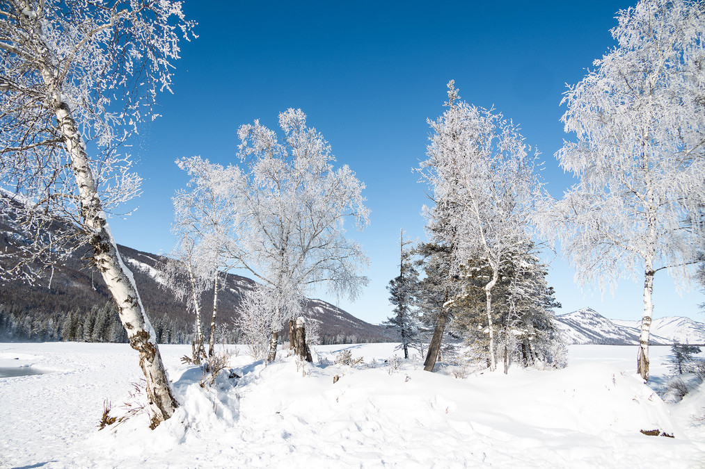
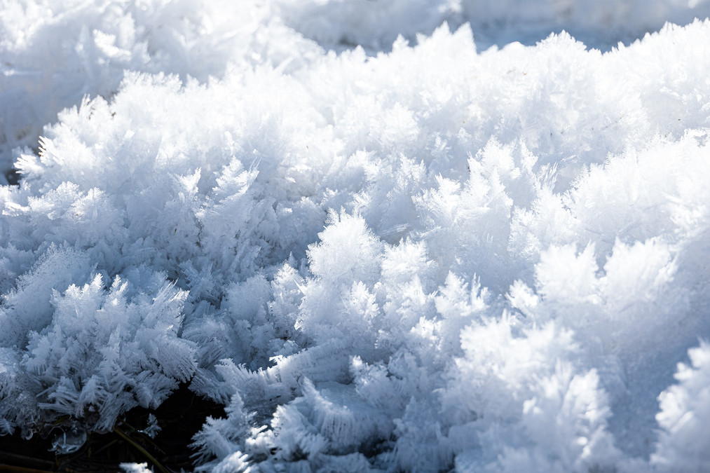
Under the sunlight, the rime is glowing with crystal light, and the mountains and forests are swaying dark green rosin from time to time, wrapping the clear breath of snowflakes into the breath, which seems to purify the soul.
Overlooking the frozen three thousand-mile Kanas, the original clear blue lake gradually faded in the silence of winter, and the simple and simple colors outline a minimalist landscape painting. The magnificent mountains, rivers and dreamy rime scenery constitute a peaceful and pure land on earth.
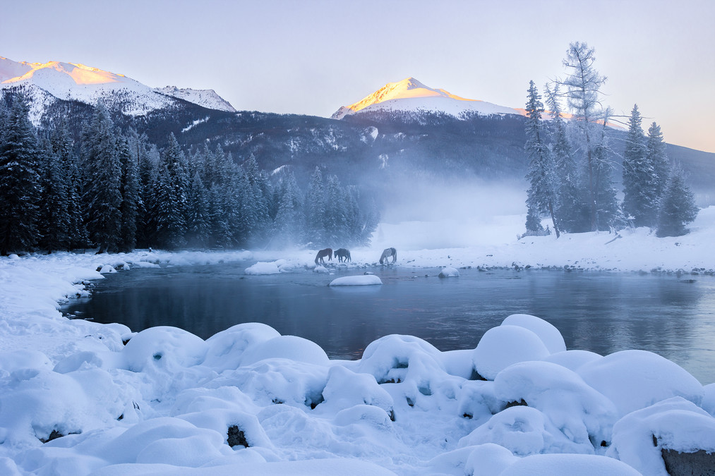
The Kanas Scenic Area in the Altay Region belongs to the Arctic Ocean water system. The virgin forests around the lake are densely covered, and the sunny slopes are covered by dense grass. The lake water comes from glacial meltwater and local precipitation from Kuitun, Friendship Peak and other mountains, and cascades into Kanas Lake from the surface or underground.
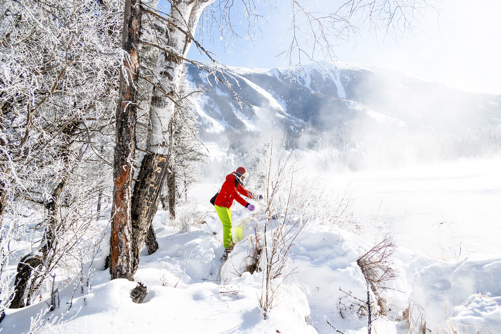
Immortal Bay in the early morning, extremely cold and extremely beautiful, low temperature of minus 32 degrees, biting cold, the drone flew out for a while and showed that the battery temperature was too low, hurriedly took a few pictures to let it come back, and the small plane that went out for a while was covered with frost.
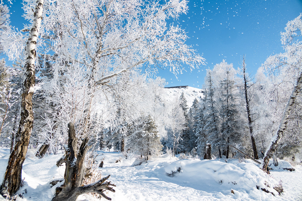
Walking through the rime-covered mountains and forests, it is as if you have entered an ink painting scroll. The breeze is blowing among the Qiongzhi jade trees, and the snowflakes are falling one after another, which is intoxicating.
The fog in Fairy Bay is crystal clear, like a fairy tale world.
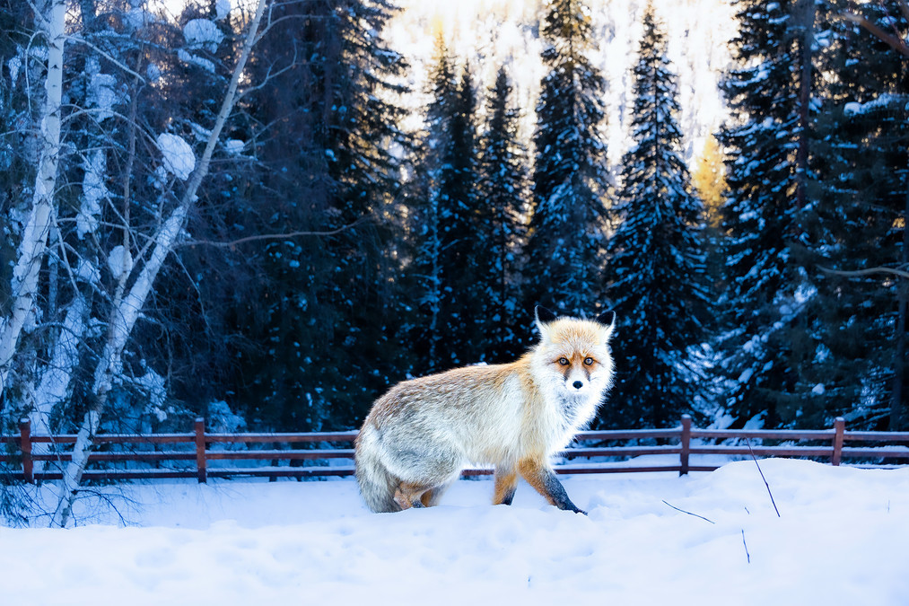
In Moon Bay, I encountered a little fox who came out to feed. The little fox was not afraid of people, but was timid. People ran away when they approached it.
The Kanas Scenic Area in the Altay Region belongs to the cold and temperate zone. The winter lasts for 7 months. The unique geographical environment makes the Kanas Scenic Area welcome the first snow from the end of September to the beginning of October. The precipitation is concentrated in the mountainous areas. The plain area has less precipitation and large evaporation, with an average annual precipitation of 177.4 mm. Kanas Lake is located in the Altay Region of Xinjiang Uygur Autonomous Region. The annual precipitation is about 1000 mm, and the maximum precipitation zone is 2100 meters above sea level. Winter is long and snowfall is abundant, usually frost starts in early August. Above 1400 meters above sea level, snow starts in late August; above 3000 meters above sea level, snow starts in early August, and it lasts until late May or early June of the following year. The snowfall period lasts for 8 months.
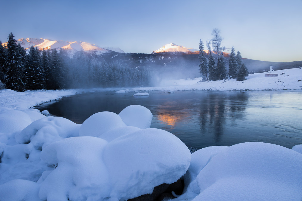
Morning at Kanas Old Bridge, peaceful and picturesque.
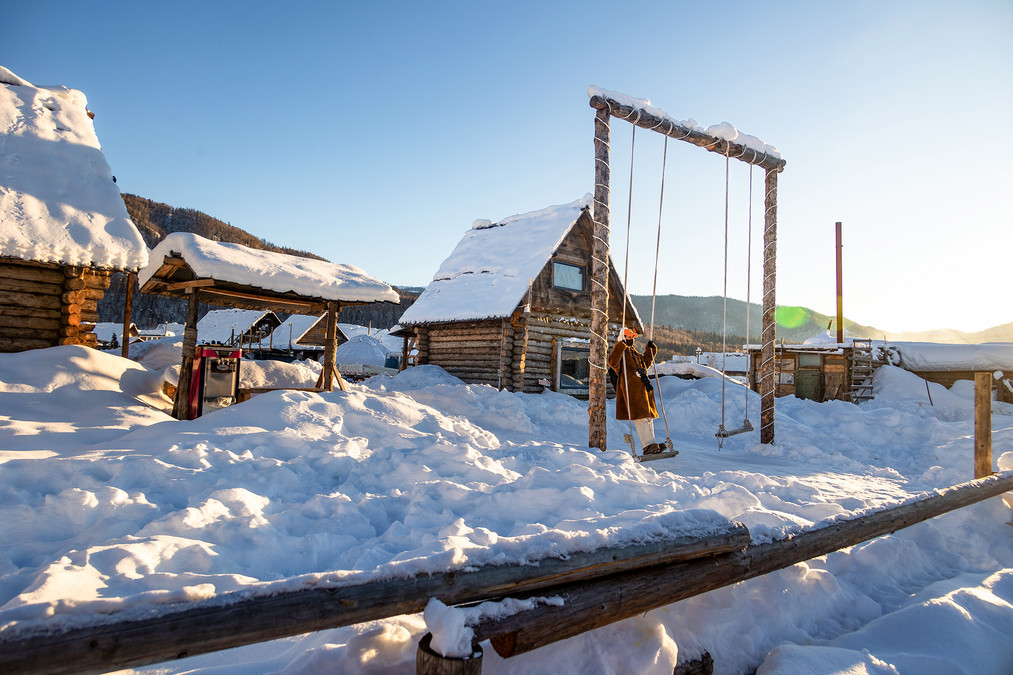
Watch the smoke curl and encounter the fairy tale winter day - Hemu Village
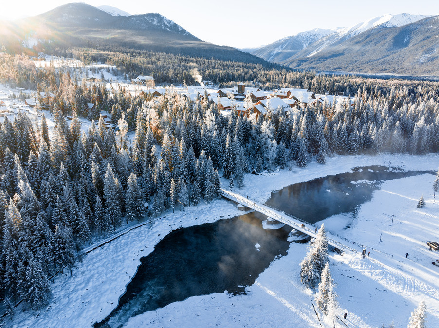
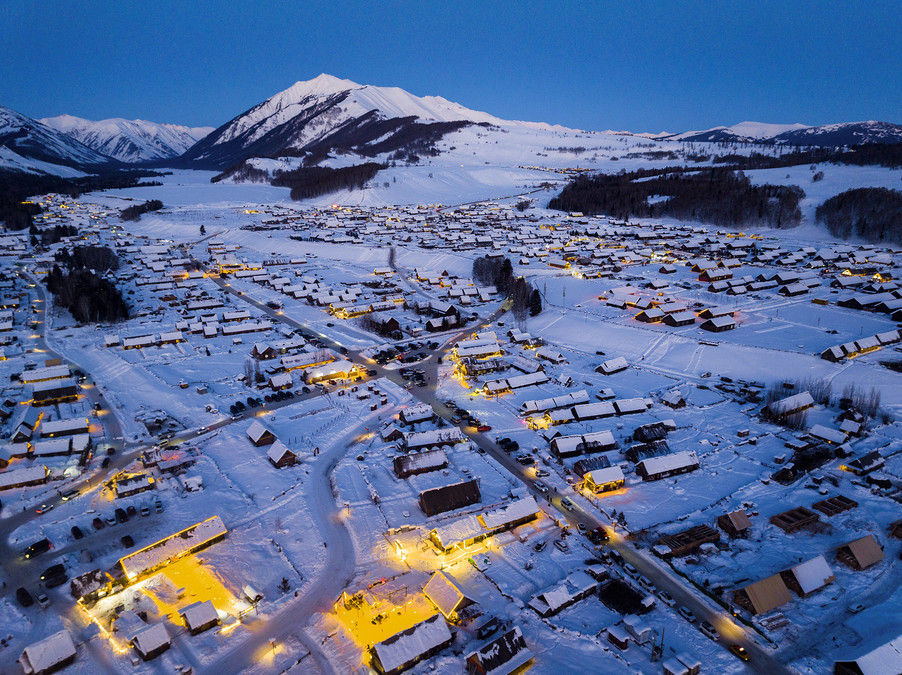
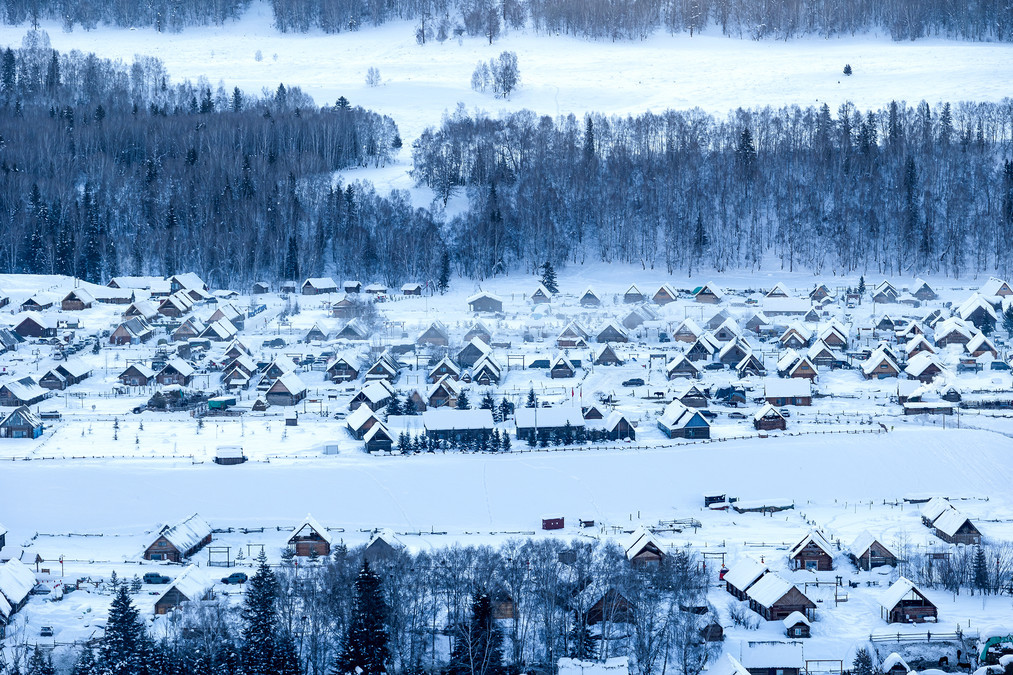
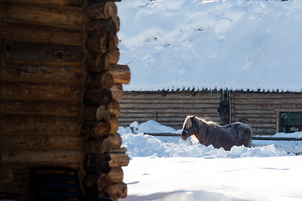
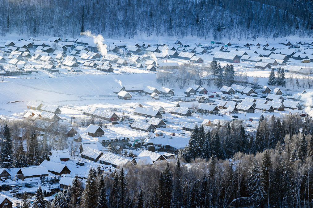
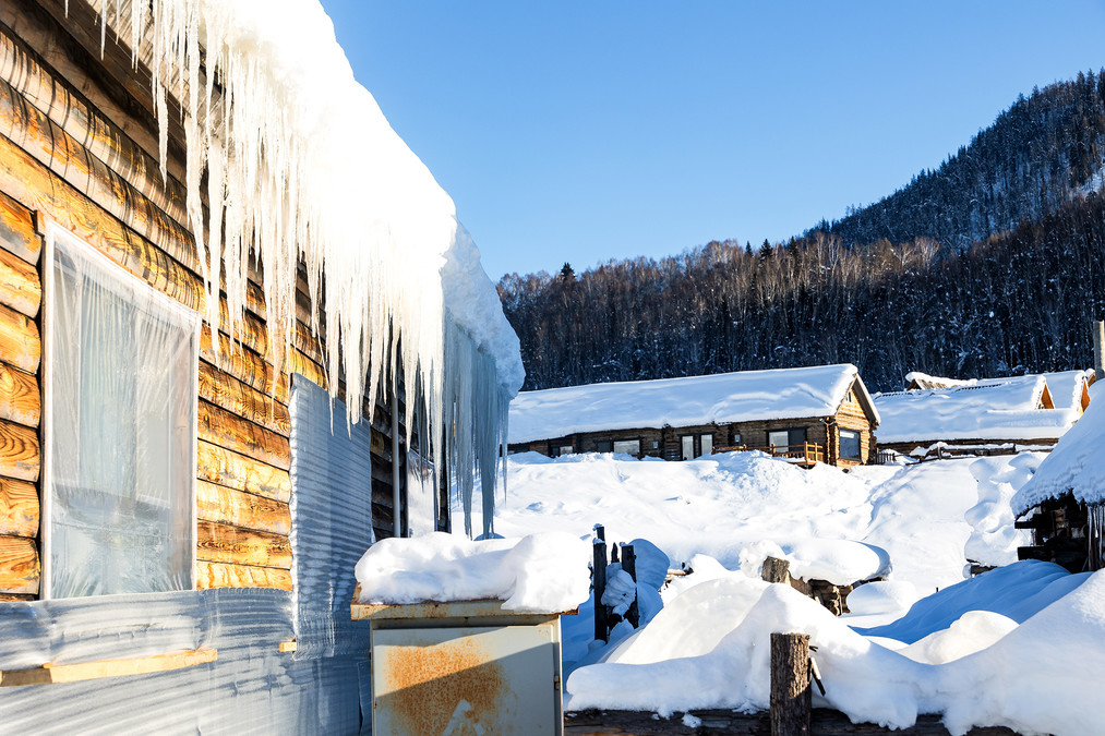
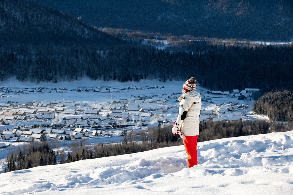
The winter in Hemu Village, Xinjiang is breathtakingly beautiful. In the distance, there are mountains covered with snow, shining with golden light under the sun. At the foot of the mountain, there are quaint wooden houses scattered in a row. Smoke rises from the roof, and soft snowflakes slowly float in the blue sky. The trees in the village are all wrapped in silver, and the ice edges hanging from the branches are crystal clear, just like a scene in a fairy tale world. Hemu Village, Hemu Kanas Mongolian Township, Burqin County, Altay Prefecture, Xinjiang Uygur Autonomous Region, is located in the north of the Altay Region, southwest of the middle section of the Altay Mountains, northwest of the border Kanas Nature Reserve, The North Face is the friendship peak of the Sino-Russian border, separated by the "Y" shaped Hemu River in the south, Harapulun and Torogayito, the Hemu River in the west is divided by Kanaske Dingle and Mamankuus, the east is the Altay Mountains, the straight line distance near the Russian border in the north is 55 kilometers, the straight line distance near the Kazakh border in the west is 51 kilometers, and the straight line distance near the Mongolian border in the east is 38 kilometers. It is about 70 kilometers away from Kanas Lake and is far from Burqin County 165 kilometers, covering a total area of 1,590 square kilometers. Hemu Village is located in the Kanas Scenic Area, which is a settlement of the Mongolian Tuva people. It has the most complete and oldest Tuva tribe in China, and there are attractions such as Jikplin International Ski Resort, Hemu Bridge, and Harden Observation Platform. Hemu Village is located in the basin formed by the confluence of the Kanas River and the Hemu River, with an altitude of 1124 to 2300 meters. It is a hilly mountainous terrain with a trend of high north and low south, and the Hemu River passes through. Hemu Village has a cold temperate and alpine mountainous climate, with an average annual temperature of -4 ° C to 9 ° C. There is no obvious summer throughout the year. Only spring and autumn are connected. The winter lasts for 7 months, and the maximum snow thickness can reach 3 to 5 meters.
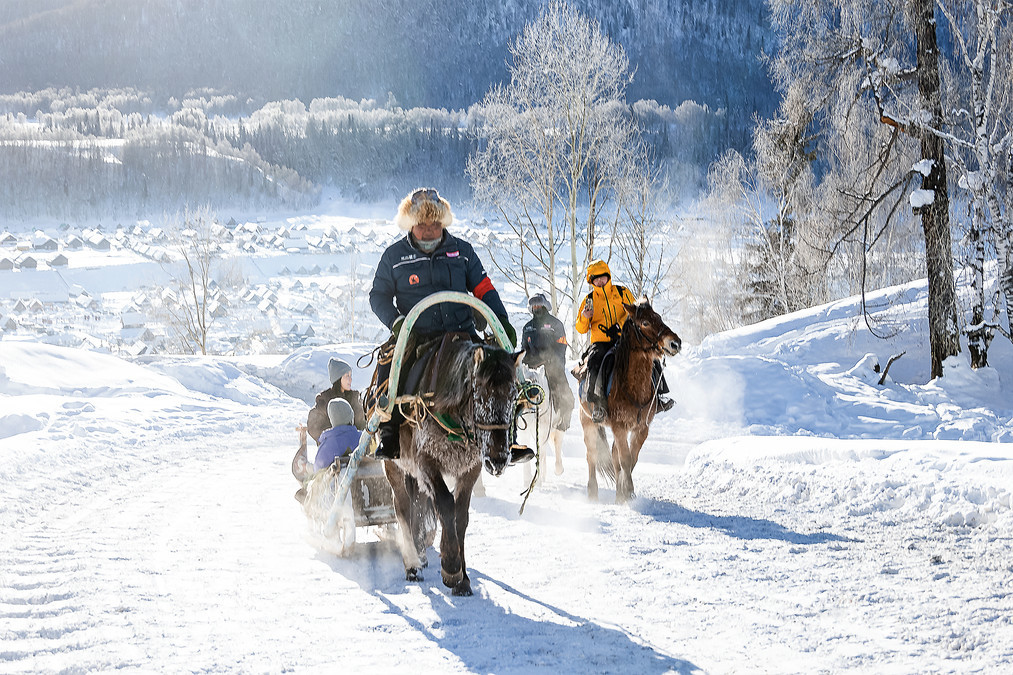
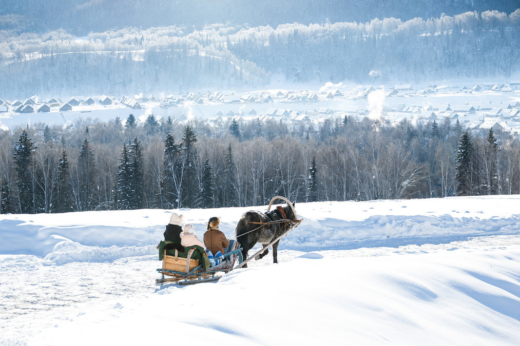
Early in the morning, take a horse-drawn plow to the Harden Observation Deck to shoot the morning sun in Hemu Village.
In the birch forest in winter, there is no emerald green and hustle and bustle of summer, but it is a little more quiet and mysterious. Crystal and translucent ice edges hang on the tree trunks, as if they are carefully arranged ornaments by nature, each one shimmering with dazzling light. In the forest, there are occasional birdsong, which is crisp and pleasant, breaking the silence of winter and making people happy. Here, you can take photos as much as you like, and each photo will be a unique work of art.
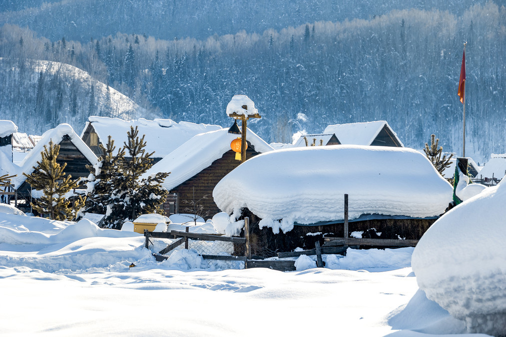
Walking into Hemu Village in winter, the first thing that comes into view is the layers of small wooden houses. These wooden houses are covered with thick snow, revealing only the mottled roofs and windows. They are like a cabin in a fairy tale, quiet and warm.
In the early morning, when the first ray of sunlight penetrates the mist and spills on the snow, the whole world seems to be lit up. The golden sunlight and the white snowflakes complement each other, forming a refreshing picture. 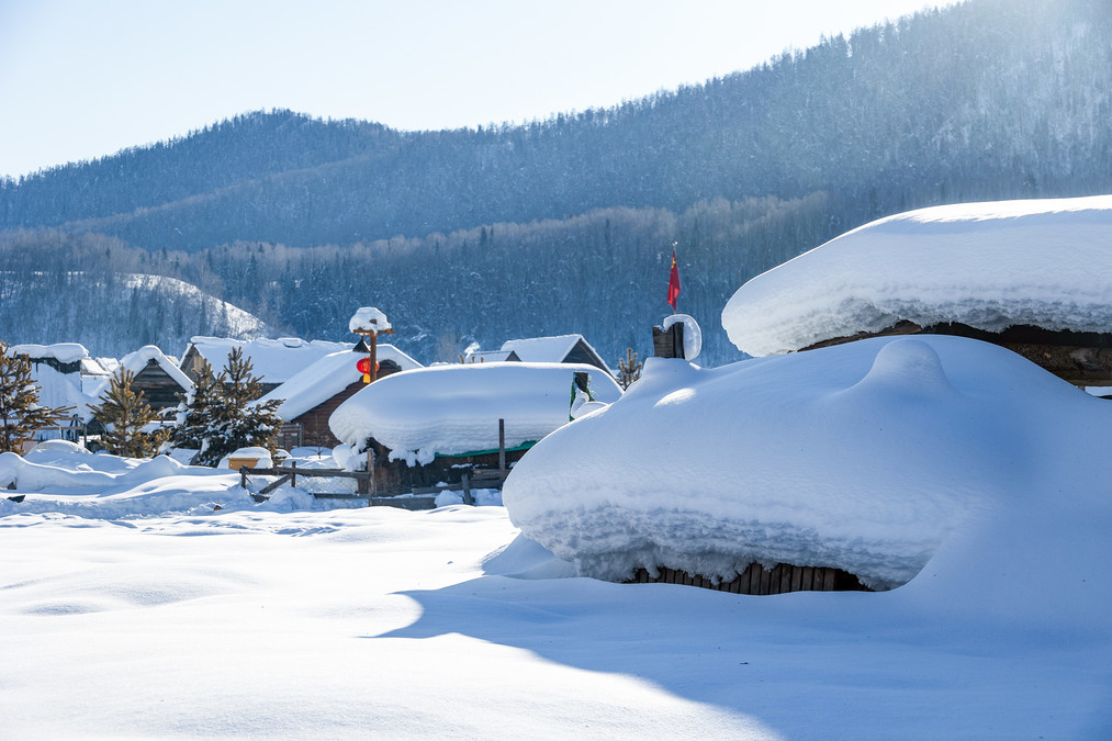
In the winter of Hemu Village, time seems to become slow and long. There is no hustle and bustle of the city here, only the tranquility and beauty of nature. 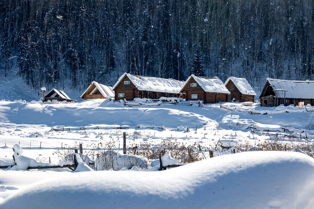
Occasionally, a squirrel or two leapt from a branch and leave a string of small footprints on the snow, adding a bit of vitality and vitality to this silent winter day.
The northern part of Hemu is covered with ice and snow all year round, thus forming glaciers. The Hemu River in Hemu Village passes through the border. With a total length of 68 kilometers, the Hemu River is the second largest tributary of the Irtysh River. It originates from the snowmelt on the Friendship Peak (4374 meters above sea level) on the Sino-Mongolian border. After meeting the Kanas River, it flows into the Burqin River, which flows into the Irtysh River, then flows through Kazakhstan, into Russia, and finally into the Arctic Ocean. 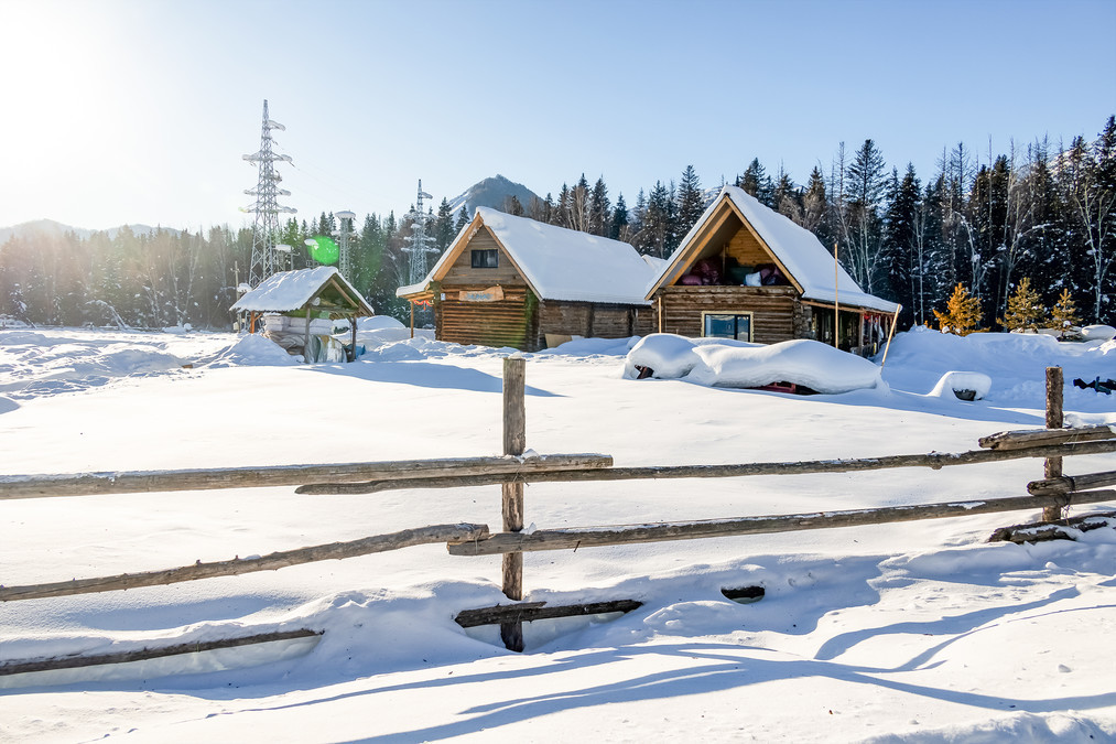
On both sides of the path are the vegetable gardens and orchards carefully taken care of by the villagers. Although it is already bleak, it looks particularly quiet under the snow.
Walking along the village path, the snow under my feet makes a "creaking" sound, which is a unique melody in winter.
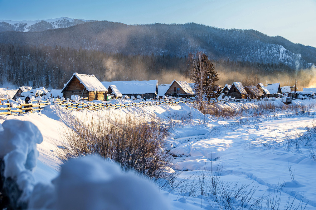
The villagers began their day, and the smoke rose, forming a harmonious and peaceful idyllic scenery with the snow-capped mountains in the distance and the wooden houses nearby.
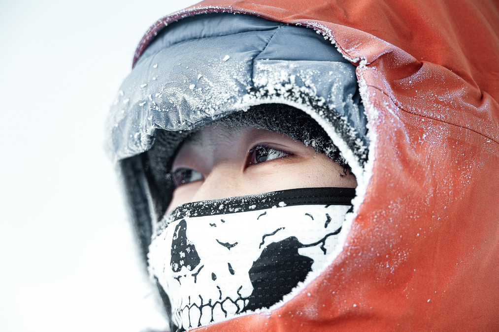
Here, the outdoor temperature is more than minus 20 degrees Celsius. Standing outside will feel the bone-piercing chill. If you don't wear gloves, your fingers will be frozen unconscious in a few minutes. We stood on the Harden Observation Deck for a while, and the hot air we exhaled turned into ice scum, and the eyelashes were covered in ice flowers.

The face is covered in ice flowers.
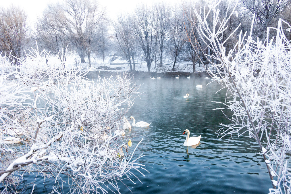
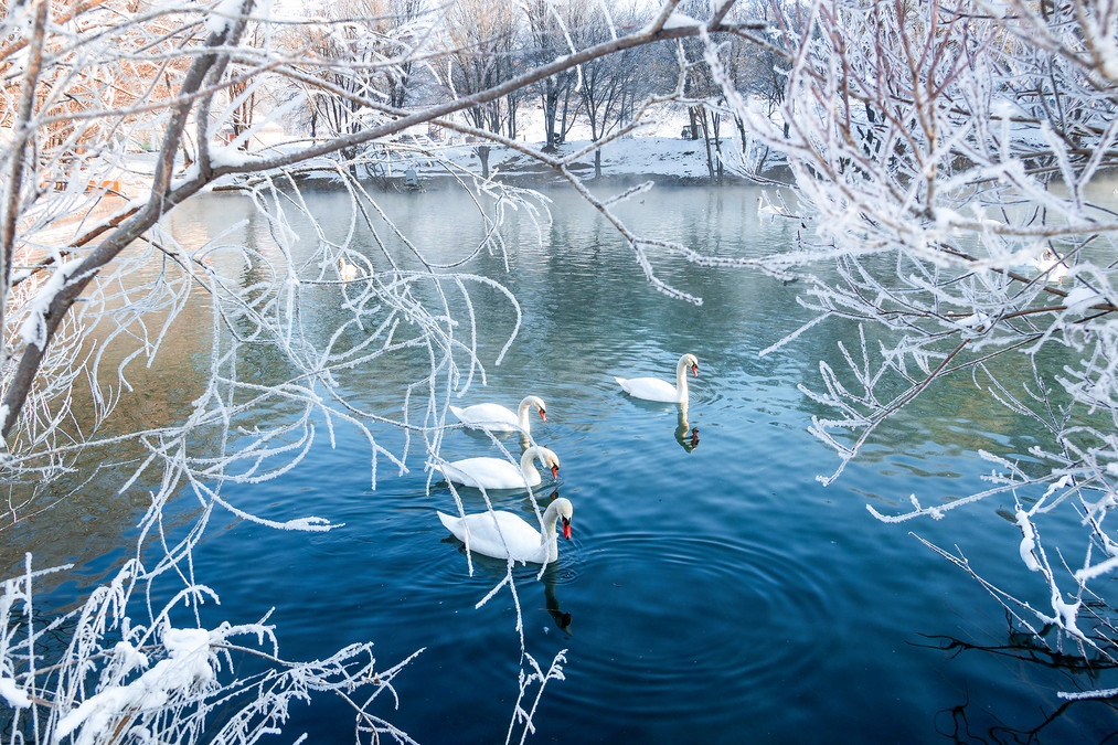
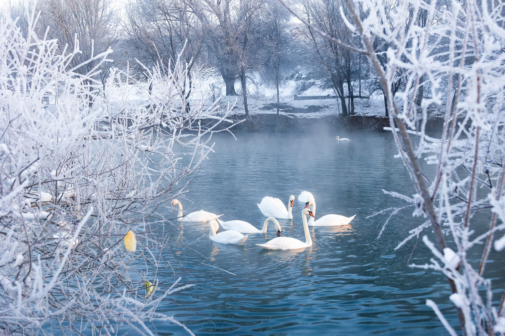
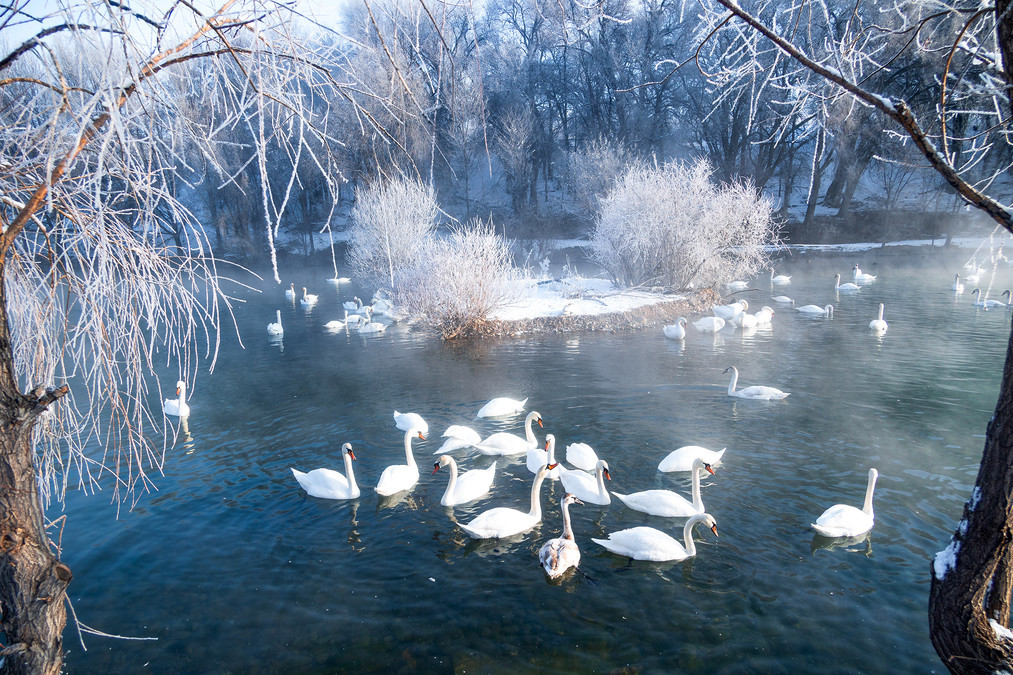
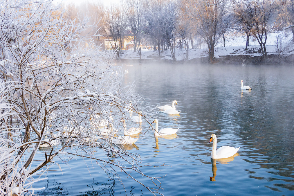
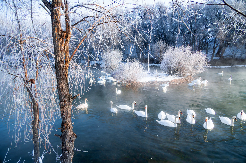
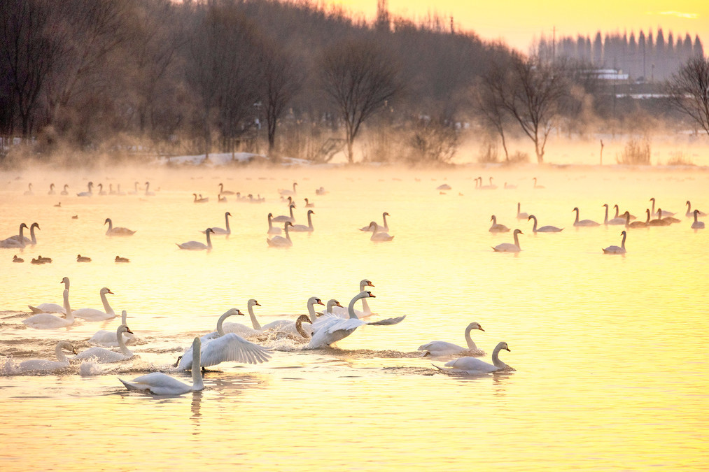
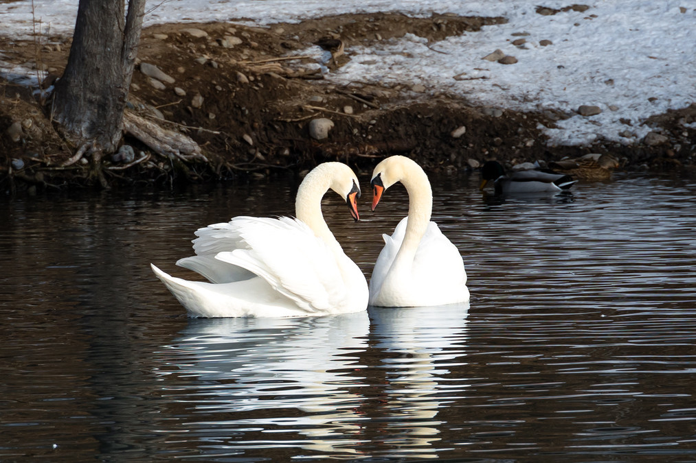
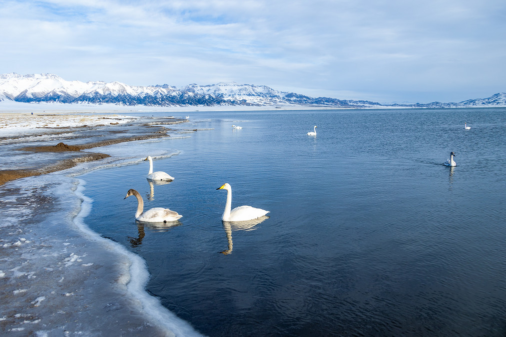
Swans dance in the morning - Yining Swan Spring
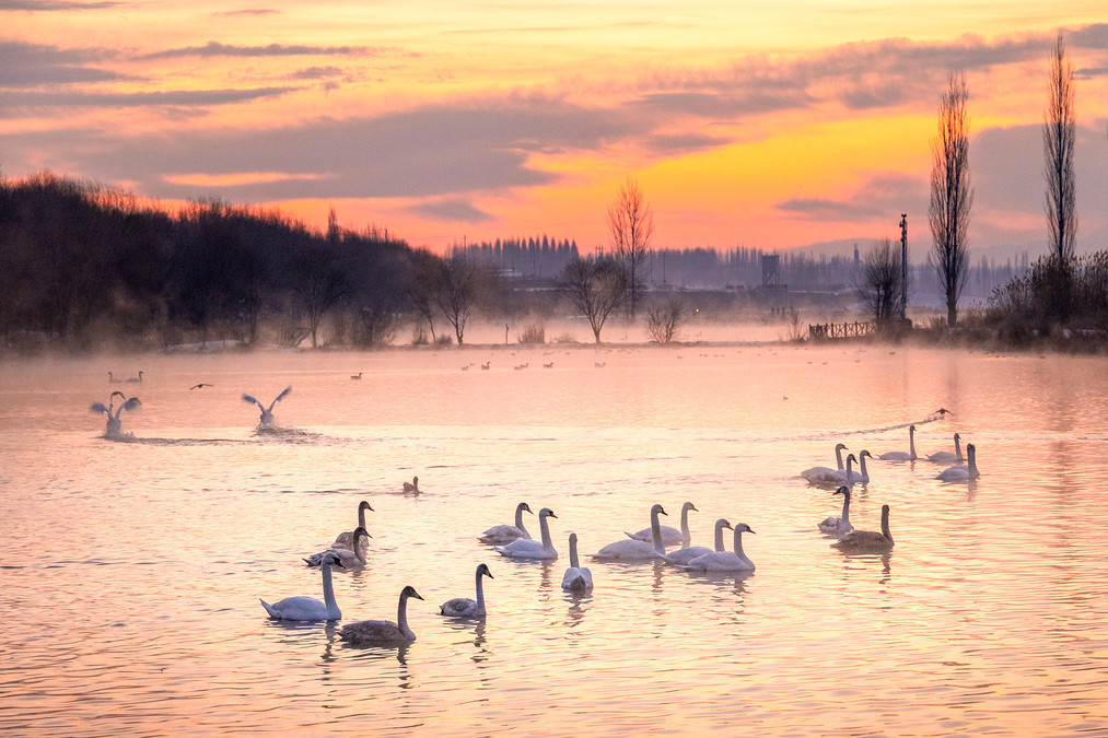
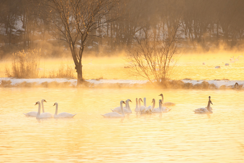
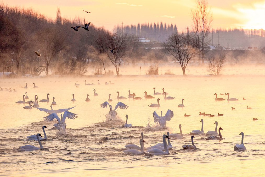
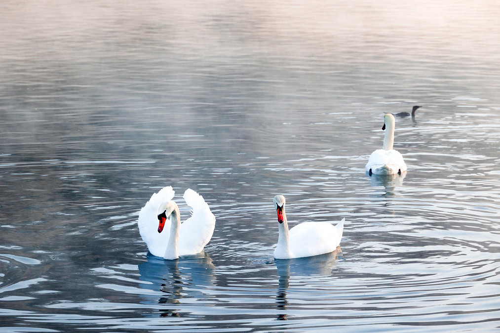
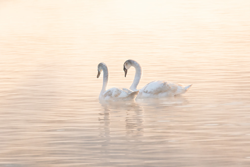
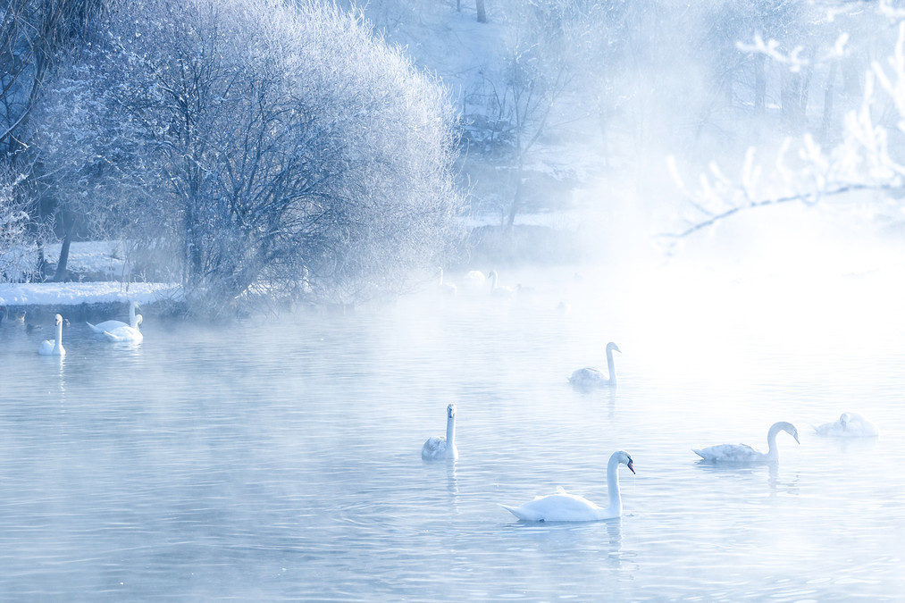
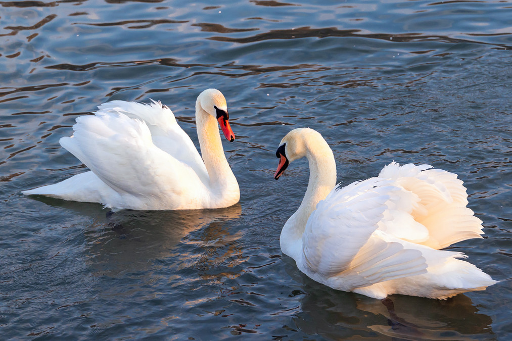
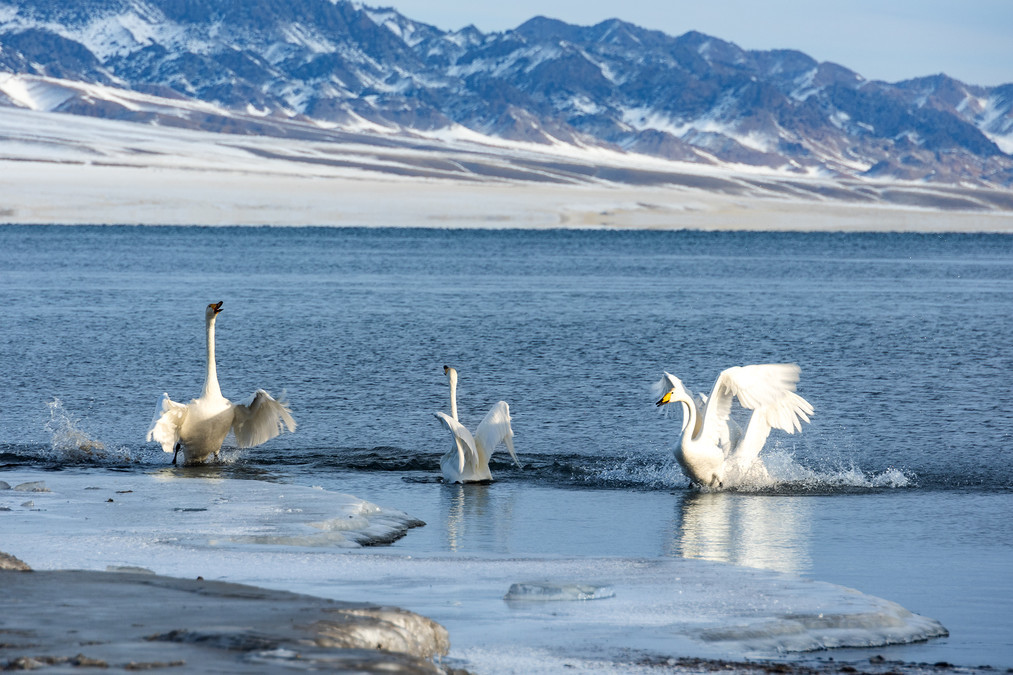
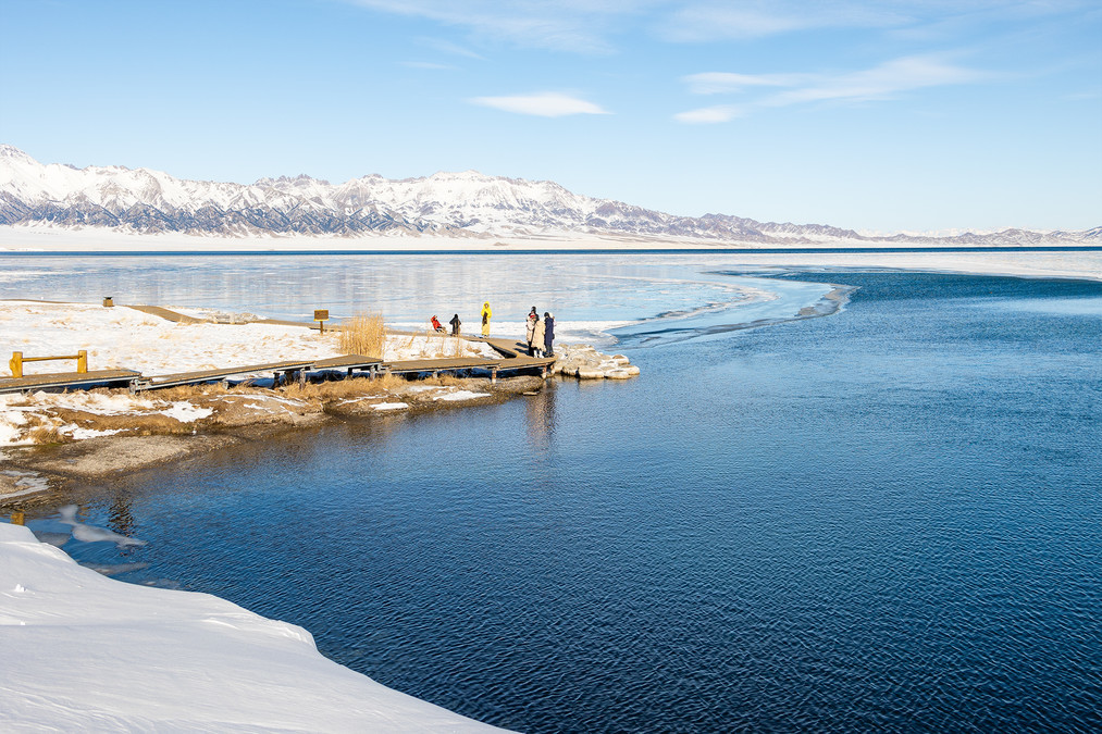
Yining Swan Spring Wetland Park is located on the north bank of the Yili River in Xiahelike Village, Yingtamu Township, Yining County, Ili Kazakh Autonomous Prefecture, Xinjiang. It is about 40 kilometers away from the urban area of Yining and can be reached by car in about 1 hour. This is the only swan habitat in the Yili River Valley that does not freeze in winter. Thanks to the action of underground hot spring water, the lake surface can keep the water rippling and foggy even in the coldest winter, like a wonderland. From October to April of the following year, flocks of Mute Swans and Whooppers fly here to overwinter. When the weather is nice here, you can see the wonders of rime in the early morning, and the rime dances with swans, which is very beautiful. Or in the evening blues moment, the afterglow of the setting sun shines on the lake, and the whole picture is dyed with a dreamy blue, which is perfect for photography. The swans in Yining Swan Spring mainly come from Balkhash Lake in Kazakhstan and Russia. Every year at the end of October, these swans will fly thousands of kilometers from Balkhash Lake to Yining Swan Spring Wetland Park to roost and overwinter, and then fly back to Balkhash Lake to lay eggs and hatch in early March of the following year.
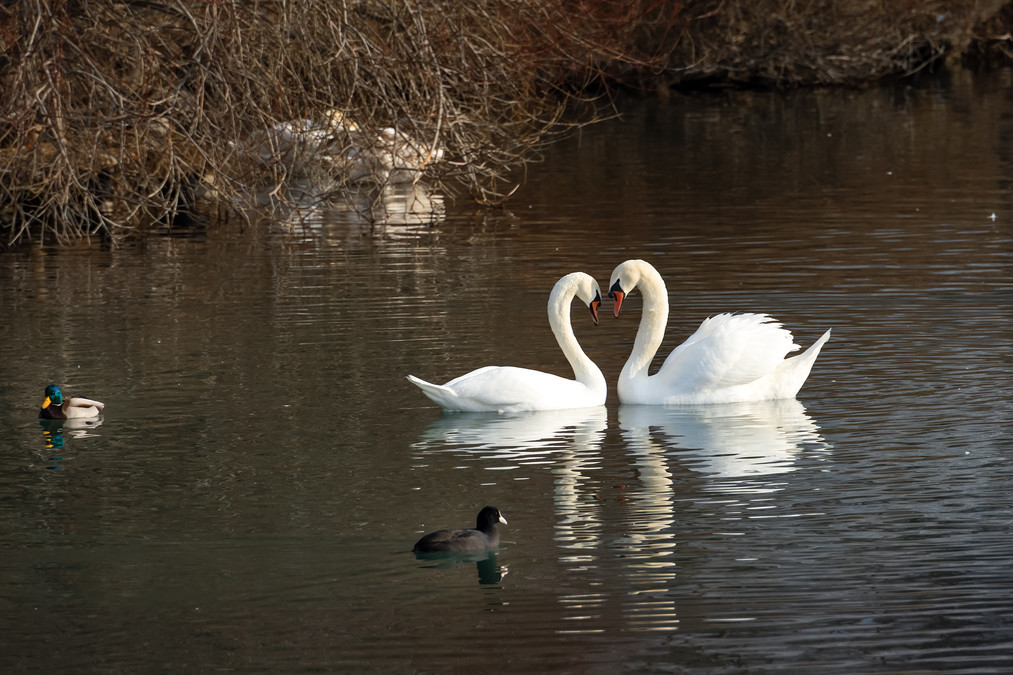
The village of Shahelek is adjacent to the Yili River. It is a village dominated by Kazakhstani people. There are fish ponds by the river, and the "Swan Lake" with an area of only 120 acres is located between the fish ponds and the houses. The "lake" is flanked by the houses of the villagers, while the wart-nosed swans give up flying to the warm south when winter comes, and play and forage here without worry.
According to local villagers, there was no such thing as a small lake here, but there were several springs under the steep slope, which continued to flow, forming a stream. In the 1980s, the villagers developed aquaculture on the banks of the Ili River and built many fish ponds, so they launched this water near the spring to preserve the spring water and use it to replenish the fish ponds. For more than a decade, lush aquatic plants have grown in the small lake, and the spring water temperature is high, which will not freeze even in the coldest season. These have created conditions for the Mute Swan to overwinter.
In 1993, Han Xinlin, a local villager who is engaged in aquaculture in this water, saw a pair of white swans and three gray cygnets mixed with his own native geese. Lao Han did not drive away the "uninvited guests", but began to feed together. Later, this family of swans came every year, and brought more and more swans here. Because this underground hot spring does not freeze in winter, swans can not only guard against foxes and wolves, but also aquatic plants provide rich natural food. Now every year from the beginning of October to the following April, Mute Swan (a national second-class protected bird) and Whooper Swan roost here every year. 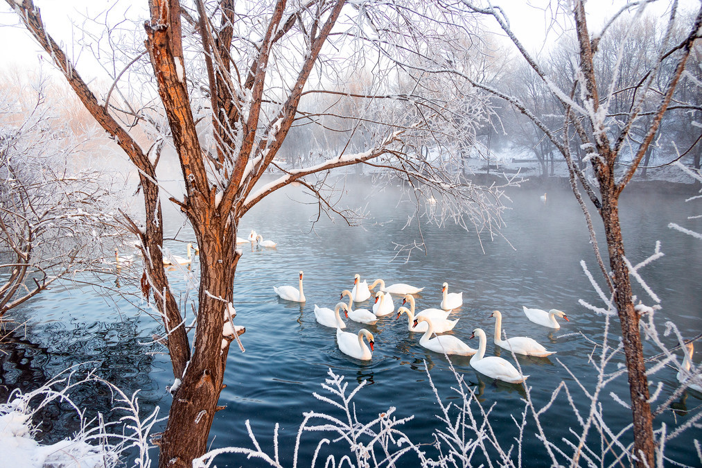
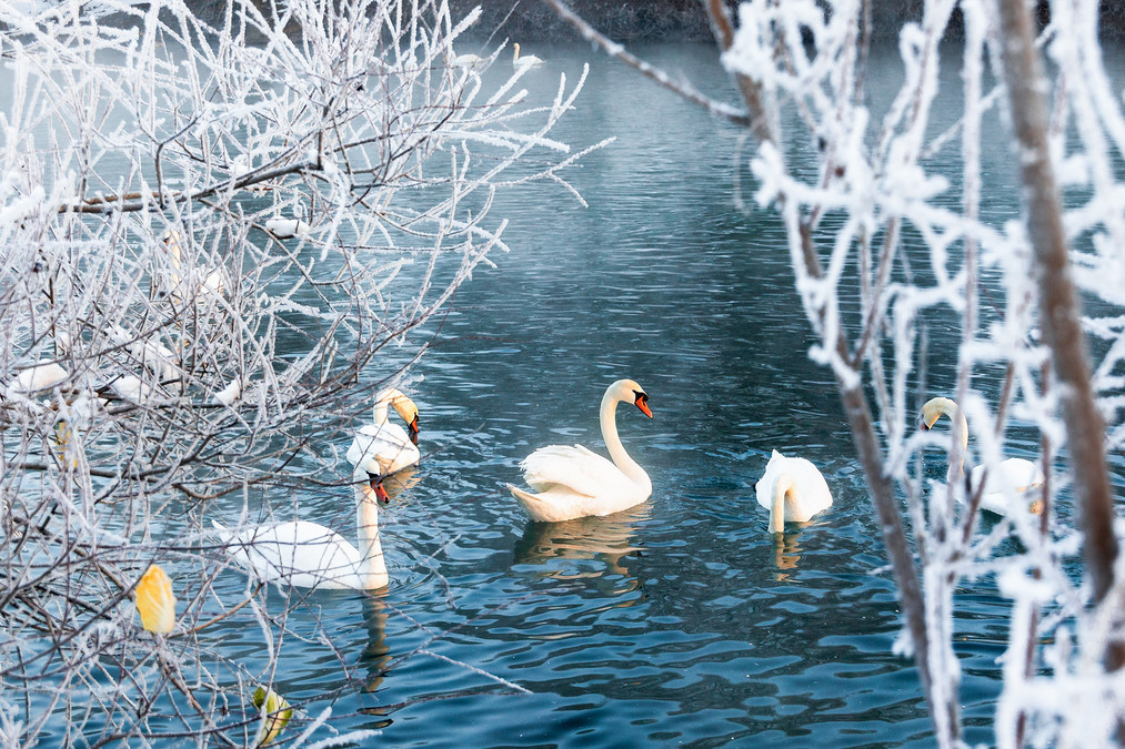
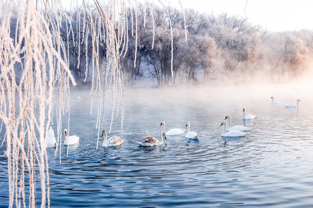
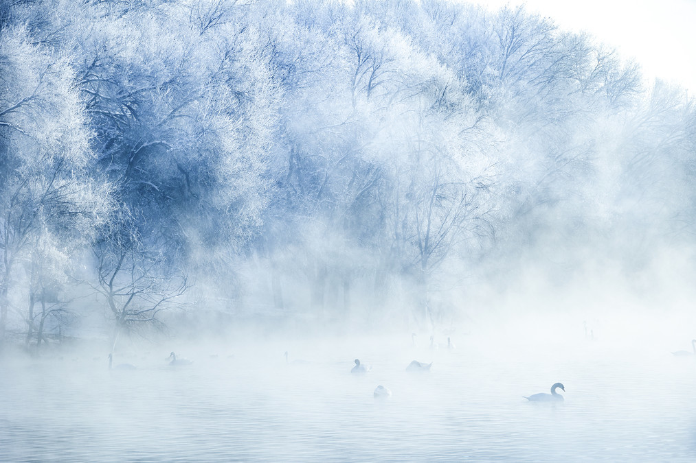
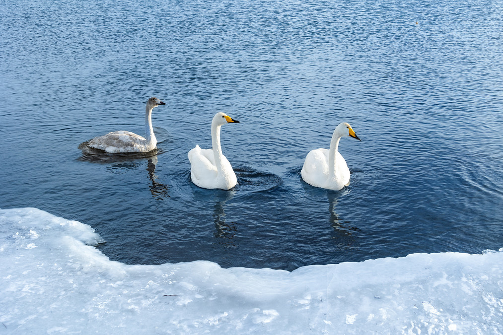
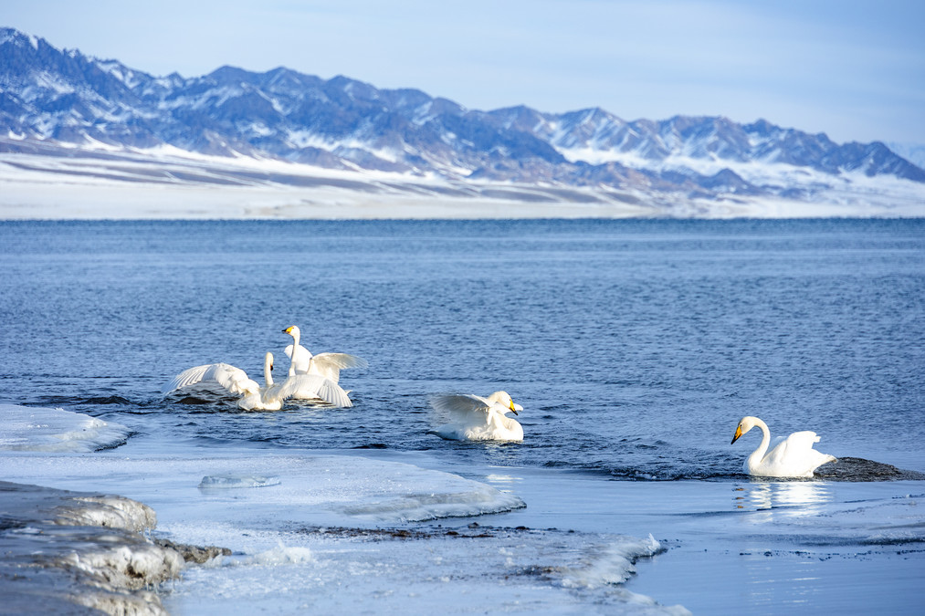
Crystal clear rime and flawless white swans form a stunning and unparalleled picture of beauty, like a paradise. That hazy and ethereal scene feels like a world away. 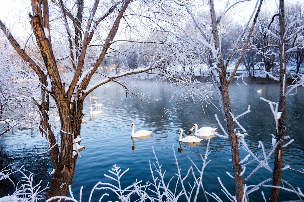
The east is gradually dyed, and the sky is unveiled as a prelude to sapphire blue; by the water bank, the leafless branches are covered with rime, like jade silver.
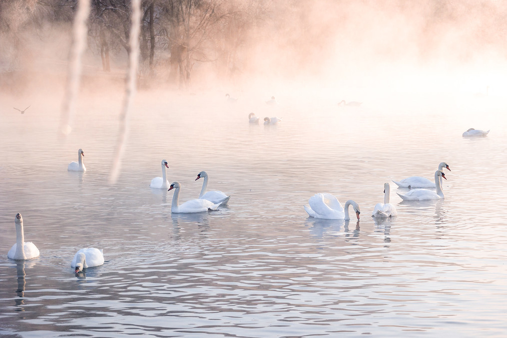
On the clear and peaceful water surface, a curling mist rises, and the small trees and reed flowers by the lake are covered with rime. Swans looming in the morning fog, whispering softly, entangled, graceful, sometimes walking gracefully in the water, sometimes sticking their heads in the water to forage.
The fog that is evaporating on the water surface dances like a veil, gathering and dispersing. The swans are graceful, using the clear water as the stage, the light fog as the curtain, and the rime as the background, swimming freely on the water surface. They shuttle between the fog, looming, as if staging an unpredictable fantasy play.
A foreign land from the west, the spiritual soil outside the world - Sailimu Lake
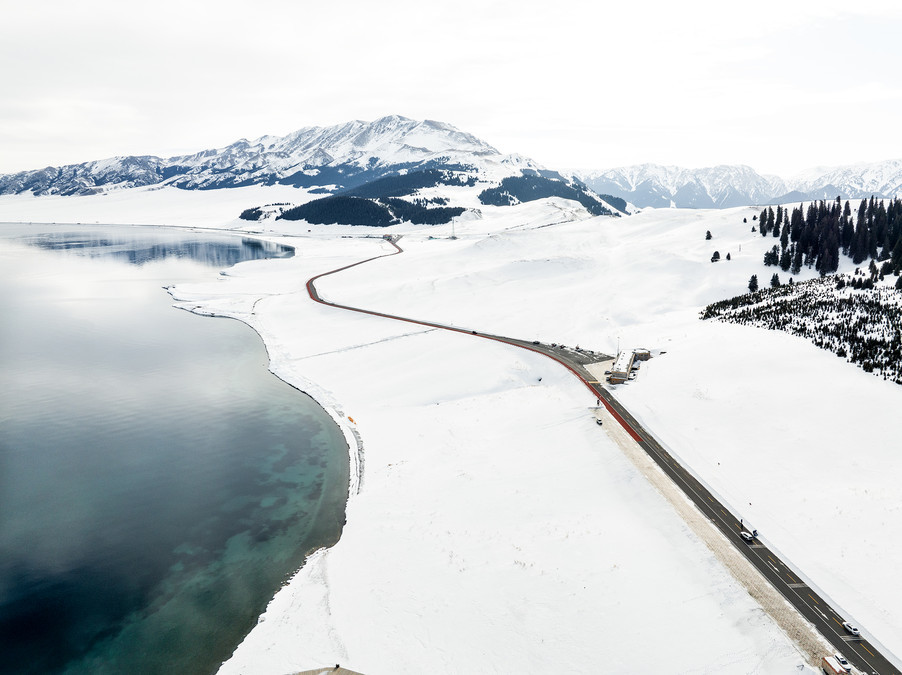
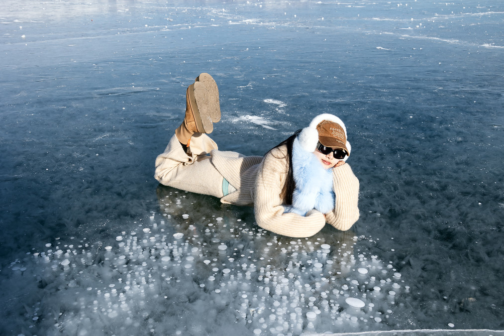
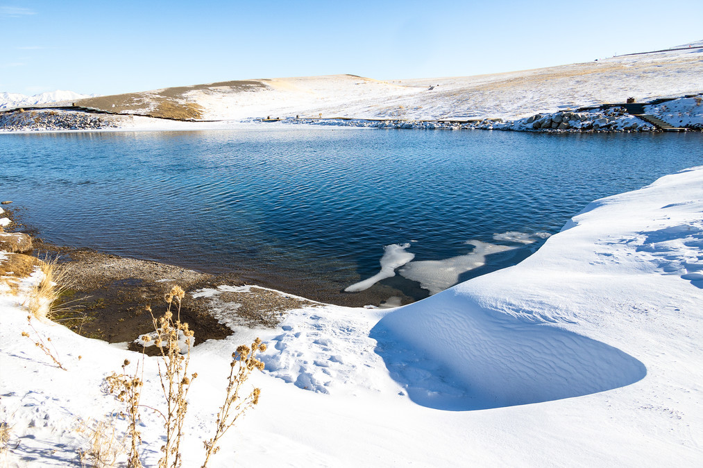
Sailimu Lake is located in Bole City, Bortala Mongol Autonomous Prefecture, Xinjiang Uygur Autonomous Region, formerly known as" Jinghai ". The lake is 2071 meters above sea level, with a longest length of 29.6 kilometers from east to west and a widest width of 25.7 kilometers from north to south, covering an area of 458 square kilometers. The lake water is crystal clear and has a transparency of 12 meters. It is the highest and largest alpine lake in Xinjiang. Sailimu Lake is 2,073 meters above sea level, like a sapphire held by the mountains. The Mongolians call it "Sailimu Naoer", which means "lake on the spine of the mountain". In winter, the lake freezes, and the lake ice is matched by the snow on the distant mountains. The scenery is magnificent. The lake surface will condense into blue ice when the cold wave comes. The sun reflects deep blue light through the ice layer. There are countless bubbles sealed under the ice layer, stacked on top of each other, like constellations in the sky falling into the lake. The winter of Sailimu Lake is an ice and snow paradise for wild animals. The secrets of winter are hidden under the lake surface. The ice bubbles twinkle and scatter like stars. Blue ice is like a picture scroll, and the ice bubbles play and are full of vitality. Standing by the lake, the cold wind is cold, but it cannot blow away the shock in the hearts of tourists. Between heaven and earth, it seems that there is only this piece of blue ice, pure, ethereal and mysterious, which makes people hold their breath for fear of disturbing this dreamlike holy land. The winter of Sailimu Lake is not only a quiet picture scroll, but also a moving poem. Here, the blue ice tells the story of time, the bubbles record the change of seasons, and the laughter of tourists adds vitality and vitality to the icy world.
Sailimu Lake in winter is like a fairytale wonderland, quiet and beautiful. The snow-covered lake is crystal clear, reflecting the blue sky and white clouds, like an elegant ink painting scroll. At sunrise, golden light fills the lake, beautiful as a dream; at sunset, the lake seems to be plated with a layer of gold foil, quiet and deep.
Sailimu Lake in winter has blue lake water, frozen snow-capped mountains, especially after a snow, looking around, it is really half blue, half white, looking at this blue and white world for a long time, at that moment it seems to be at the end of the world, let the thoughts gallop freely here, everything is so beautiful.
After March of the following year, it began to thaw, and there was ice melting and ice pushing. The picture above shows the ice pushing, which is spectacular when the weather is extremely low in the morning.
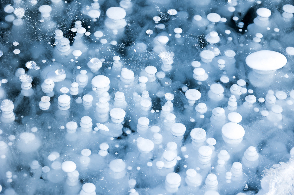
During the ice sealing process, the methane produced by the decomposition of anaerobic microorganisms under the ice layer forms beaded ice bubbles, which interweave with the ice flowers of water vapor condensation in the air to form a fantastical world under the ice.
In this blue and white world, there are beautiful swans swimming in the lake. They are like elves in this ice and snow world, magically integrated with this blue and white world, beautiful and romantic. 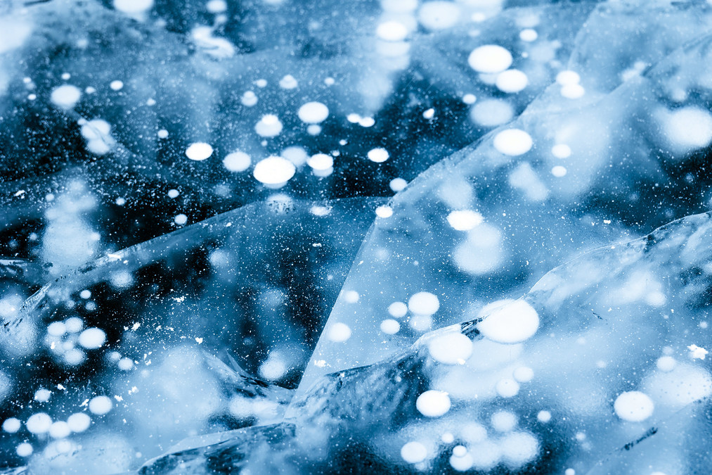
In the ice layer, bubbles are vertically distributed from the bottom of the lake, and they have different shapes in the translucent lake ice, which is very beautiful. Ice bubbles are formed by gases such as methane released by rotting plants on the bottom of the lake, which are rapidly frozen during the process of surging to the lake surface.
The formation of ice flowers in Lake Sailimu is mainly due to the sudden drop in temperature and the condensation of supercooled saturated water vapor on the ice surface. When the temperature drops sharply in a short period of time, the supercooled saturated water vapor touches the clean and smooth ice surface, and the water vapor will slowly "grow" ice flowers on the ice surface. These ice flowers are crystal clear and magnificent, and it is like walking into a dream world by the lake.
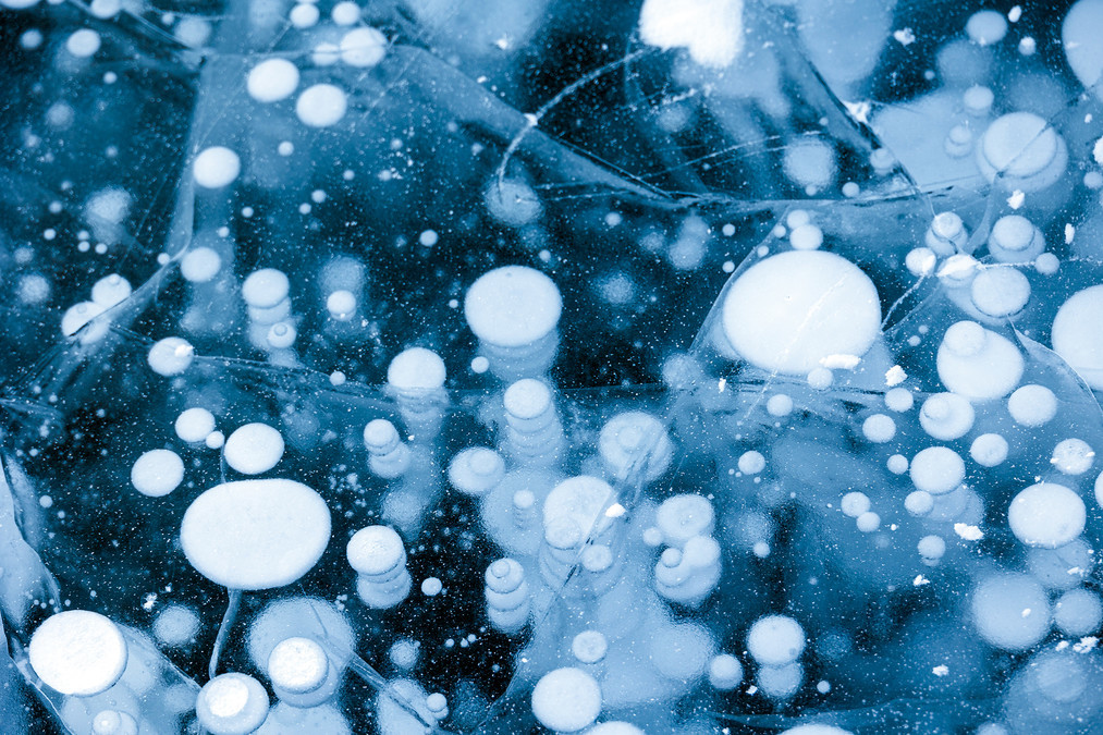
The formation process of ice bubbles in Sailimu Lake mainly includes the following key steps: Organic matter decomposes to produce methane gas: The bottom of Sailimu Lake is rich in rich organic matter, which decomposes under the action of microorganisms to produce methane gas. These gases provide "seeds" for the formation of ice bubbles. Rapid cooling and freezing bubbles: When the temperature of the lake surface drops rapidly, the ice layer on the lake surface will form rapidly. Methane gas is "caught" by the rapidly freezing ice layer during the rise, thus forming bubbles under the ice. The calm lake surface is conducive to the rise of bubbles: only when the lake surface is calm can the methane gas rise smoothly and the bubbles can "grow" steadily.
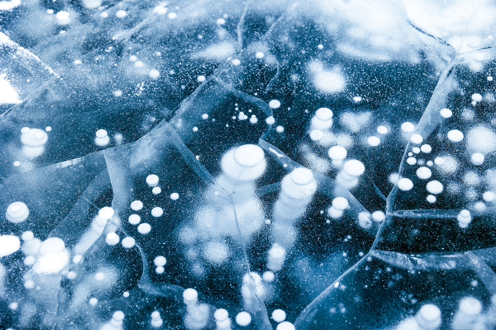
Changes in water pressure cause bubbles to expand: As the water depth decreases, the water pressure decreases, and the bubble volume gradually expands. When the bubble reaches below the ice layer, the volume will further increase, sometimes reaching a diameter of more than half a meter. The rate of temperature drop affects the freezing of bubbles: The rate of temperature drop must be fast enough for the lake surface and water layers at different heights near the lake surface to freeze rapidly in a short period of time. In this way, during the rise of methane bubbles, when they are about to reach the ice layer, due to the continuous and rapid decrease in temperature, the bubbles in the waters that have just reached the top layer are "sealed" in the ice layer because this part of the water layer continues to freeze.
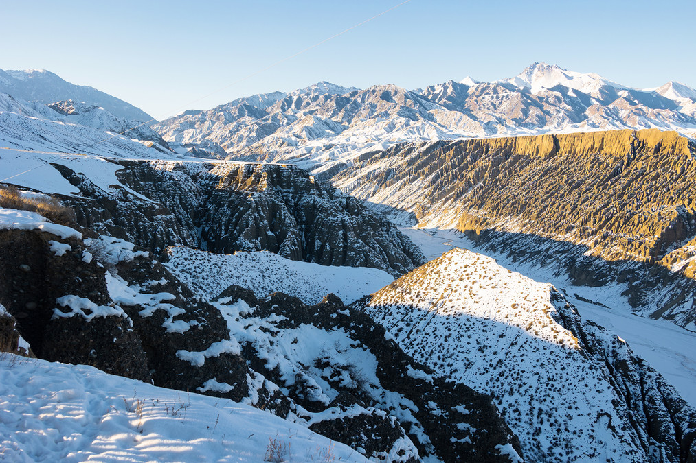
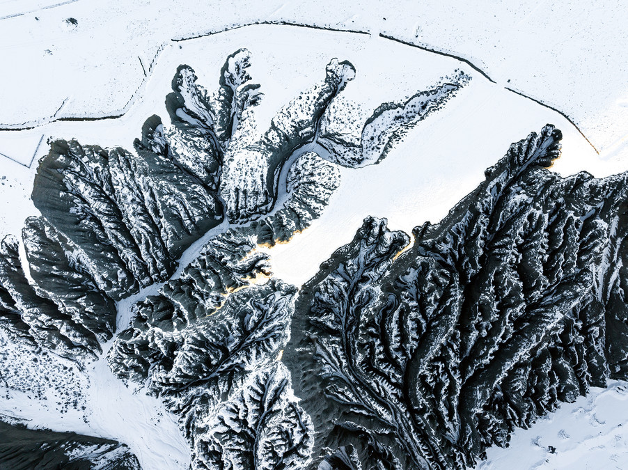
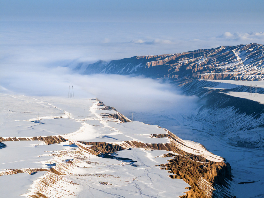
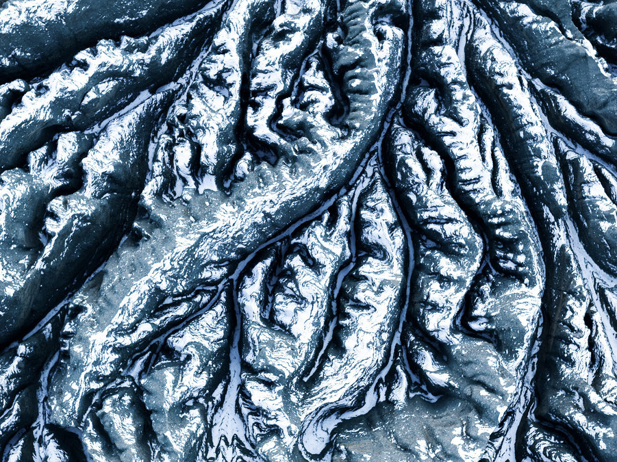
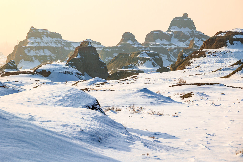
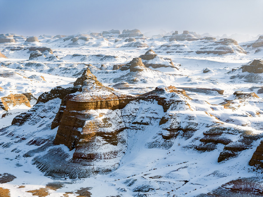
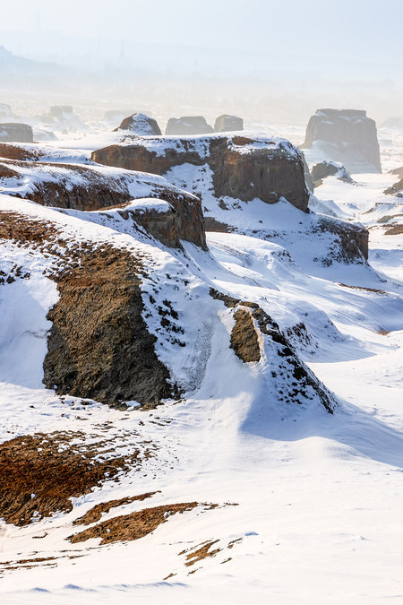
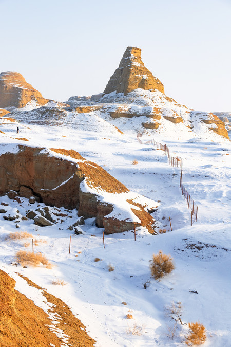
Crossing 100 million years of time - Dushanzi Grand Canyon and World Demon City
Dushanzi Grand Canyon, located in Dushanzi District, Karamay City, Xinjiang, is a natural landscape area dominated by Danxia landforms. The bottom of the canyon is about 100-400 meters wide, the shoulder width of the valley is 800-1000 meters, and the height from the bottom to the shoulder can reach 200 meters, and the altitude is 1070 meters. It belongs to a typical canyon landform. It is located at the northern foot of the Tianshan Mountains, with steep terrain and beautiful scenery. The formation of the canyon is due to the magical scenery canyon formed by the river rushing out of the Tianshan Mountains and cutting the inclined plain in the southwest direction of Dushanzi. The terraces on both sides of the canyon are vivid in my mind, and can be divided into at least nine levels. The terraces are desert grasslands, with plants such as Artemisia and Stipa, which form a sharp contrast with the steep valley walls of the canyon, forming a magnificent natural picture. The valley bottom of Dushanzi Grand Canyon is 100-400 meters wide, the valley shoulder width is 800-1000 meters, and the height from the valley bottom to the valley shoulder can reach 200 meters, and the altitude is 1070 meters. The landform here belongs to the canyon landform. The valley wall cliffs are steep, and the flowing water at the bottom of the valley coincides at times, showing the wonders of nature. Dushanzi Grand Canyon, known as "the secret realm of Duku, a wonder of 100 million years", is a bright pearl on the northern slope of Tianshan Mountain in Xinjiang. This canyon was initialized by Tianshan snow and water for hundreds of millions of years. Its magnificent scenery was once on the cover of National Geographic magazine and was the first breathtaking scenic spot on the Duku Highway.
The Dushanzi Grand Canyon in winter snowflakes fall and is wrapped in silver, dressing up the entire canyon as a fairy tale world. At this time, the canyon appears more peaceful, mysterious and romantic.
The formation process of the Dushanzi Grand Canyon is mainly due to the initialization and erosion of snow and rain in Tianshan over hundreds of millions of years. Specifically, the Dushanzi Grand Canyon is a canyon landform formed by the Kuitun River continuously cutting down to the surface. The snow water in the Tianshan Mountains converges to form the Kuitun River, cutting the inclined plain in the southwest direction of Dushanzi, forming this magical scenic canyon.
This is the filming location of film and television works such as the movie "Flying Life", the TV series "Return", "Kyushu Ethereal Record", the variety show "All the Way to Adulthood", "Goodbye Love", and "Eating Thousand Miles".
The rocks in the canyon are rich and diverse in texture, some like a stately Buddha statue, some like eagles spreading their wings to fly, with different shapes and lifelike.
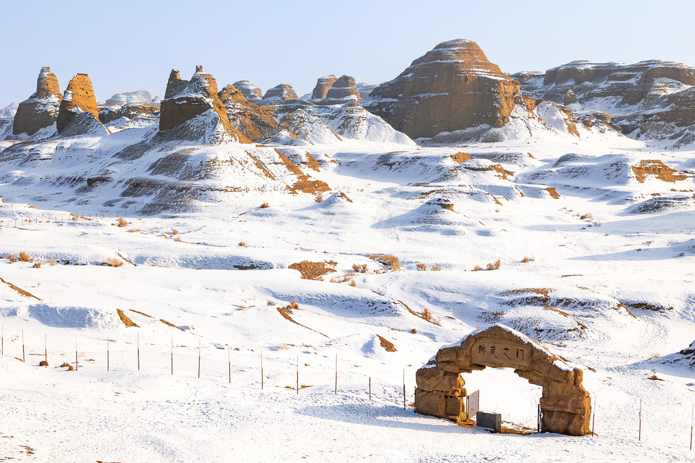
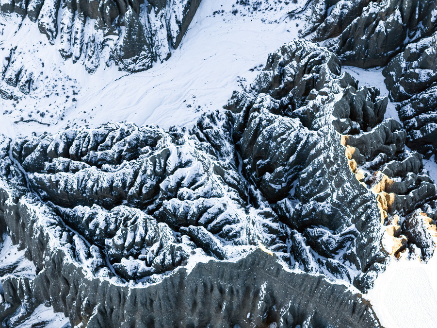
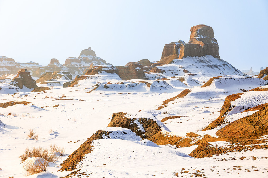
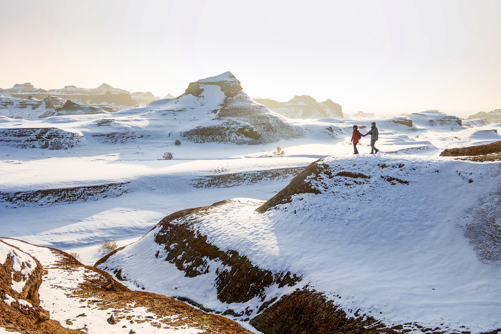
Karamay World Demon City Scenic Area, referred to as World Demon City Scenic Area, is a Yadan Landform Scenic Sightseeing Tourist Area located in Karamay City, Xinjiang Uygur Autonomous Region. The total area is 260 square kilometers, and the core area of Yadan Landform is 22 square kilometers. It runs northwest and southeast, and the scenic area is Gobi Yadan.
Karamay City World Demon City Scenic Area During the Cretaceous period about 100 million years ago, it was a huge freshwater lake with growing plants, and the water was inhabited by Wuerhe Stegosaurus, plesiosaurs, and other ancient animals. Later, after two major crustal changes, the lake became a vast sea of land sandwiched between sandstone and mud slate, which is geologically known as the "Gobi Platform".
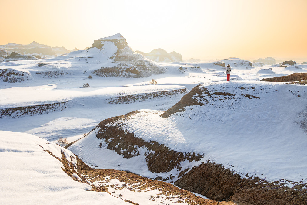
Whenever the wind blows, it will make a strange roar, so it is called Ghost City. The world Ghost City is in trend again, with the maximum wind force reaching 10-12, and it is one of the important "clocks in the northern Xinjiang tourist ring."
The geomorphological development of Devil City began with the Himalayan orogenic movement, which caused some red strata to tilt and ease folds, and caused the red basin to rise, forming an outflow area. The water concentrated in the low-lying part of the middle of the basin, eroded along the vertical joints of the rock layer, and formed two upright deep trenches, called alleys. When the water at the foot of the alleys and valleys cannot be completely removed, the avalanche cones with a gentle slope are formed. As the trench wall collapses and retreats, the collapse cone continues to grow upward, and the area covering the bedrock surface also continues to expand. The bedrock under the collapse cone forms a gentle slope that is consistent with the inclination direction of the collapse cone. The collapse and retreat of the cliff surface also gradually reduces the range of the peak surface, forming landforms such as fort-like remnants, stone walls or stone pillars. Devil City is a "wind erosion city", because the wind formed by the flow of air is caused by the wind, which is a wind erosion landform. The wind rolls up gravel and stones, constantly hitting, crashing and rubbing the rocks, so it will make various sounds. Rocks of different hardness accumulated over time will be blown into various strange shapes by the wind.
The strata of World Demon City are formed by the accumulation of Paleozoic sedimentary rocks over time. Therefore, the density of rocks will vary, and the thickness will also be different. In addition, it is located in a dry desert area with little rain. During the day, the blazing sun scorches the earth very hot; at night, the air suddenly drops to a very low level. The strong temperature difference prompts the rocks to break. Sometimes some cracks or holes appear, and the wind will make strange sounds when blowing over them. Wuerhe Devil City is located in a trend, with constant strong winds all year round. The strong wind carries some small stones and hits the rocks for a long time, causing the soft and hard rocks to interact inside and outside, turning them into strange stones.
Conclusion: Thank you again to the teachers who supported us. Thank you for everyone you meet, whether short or long, it is the most beautiful scenery.